Local paths
")
All these landscapes that surround the region together with the wealth of old buildings, castles and chapels scattered throughout the territory of ancient tradition and the historical record make this area ideal for excursions and hikes. The local paths are a good way to find it out.
You can consult the brochureWalks around Osona
Calldetenes
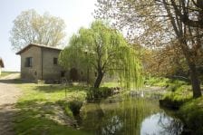
Path by the side of Sant Marti stream and various hydraulic elements which for years supplied six mills situated along its route. It is a path with bridges and steps that allow us to observe a series of canals and ditches, ponds, dams, spring wells and mills.
Distance: 3 km
Little slope
More information:http://www.calldetenes.cat/nivells/contingut/titular/ruta-dels-molins
The Romanesque route can be done in two directions starting from the Mill Hill or from the mill of High bank.
More information:http://www.calldetenes.cat/nivells/contingut/titular/ruta-del-romanic/idm/435
The route of San Marc is particularly interesting for its landscape and goes through the high part of the territory. You can start from different points, even from the center of Calldetenes.
More information:http://www.calldetenes.cat/nivells/contingut/titular/ruta-de-sant-marc/idm/436
Centelles
For many years women born in Centelles have been famous as witches. This reputation collected through stories and couplets has been transmitted from generation to generation.
Distance: 5,8 km
Dificulty: easy
More information:http://www.centelles.cat/docs%20rutes/ruta-terra-bruixes.pdf
Since Middle Ages the water of Centelles has been used for different purposes. The mills located in different parts of the place apart from its heritage interest serve as a milestone to landscape diversity.
Distance: 10 km
Dificulty: east
More information:http://www.centelles.cat/docs%20rutes/ruta-molins.pdf
The barony of Centelles formed a continuous territory where the roads of vital connecting, surveillance, merchandise etc. functions meet.
More information:http://www.centelles.cat/docs%20rutes/ruta-baronia.pdf
Folgueroles
Aunque tiene un tramo de escaleras, éste es un recorrido corto, cómodo y de poca dificultad. Las escaleras son con escalones irregulares sobre piedra y tierra. El desnivel es de casi 50 metros.
Si quieren hacer el camino de escaleras de bajada, seguir el recorrido per la Damunt, hacia Pou y los Foquers.
Distancia: 3 Km
Grado de dificultad: bajo
Duración: 1 hora
Más información: http://www.folgueroles.cat/visitans/senderisme/les-escales-del-foquers
Tipo de Ruta: Pequeña ruta
Distancia: 6 km
Grado de dificultad: bajo
Duración: 1,5 h. aprox
Usos: a pie y BTT
Señalitzación: buena
Más información a la sección de la página web del ayuntamiento de Folgueroles dedicada al senderismo.
Esta es una ruta corta (2km), que se puede hacer en poco más de una hora. Puede servir para hacerla sola o como atajo en diagonal que divide en dos partes la ruta Verdagueriana. Es un recorrido cómodo y llano. Sale de Folgueroles por la Font de la Ricardera, pasa por la Codina, detrás el Gelabert y sube la colina de St. Jordi de Puigseslloses. Sant Jordi es una ermita muy apreciada por todos los els folguerolenses. Allí el mossèn Cinto cantó misa y, como decía él, es un botón en medio de la Plana.
Distancia: 2 km
Grado de dificultad: bajo
Duración: 1 hora
Más información: http://www.folgueroles.cat/visitans/senderisme/sant-jordi-de-puigcheslloses
Este itinerario no tiene ninguna dificultad si se sigue la señalización. Es un bonito recorrido que atraviesa bosques de pinos, robles y alcinas. Nos sube a los alto riscos, desde donde hay unas bonitas vistas.
Distancia: 10 km
Grado de dificultad: Bajo
Duración: 3 horas aprox.
Usos: a pie y en BTT
Señalitzación: Regular
Més informació:http://www.folgueroles.cat/visitans/senderisme/sant-llorenc-del-munt
Gurb
Its route passes through the sports zone, Mother of God of Palau, Granollers de la Plana, Pineda Vella, Chocovic and sports zone.
Distance: 18,8 km
More information:http://www.gurb.cat/index.php?menu=115
Its route passes through the sports zone, Spring Water of Cases d’Avall, New house of Argila, Muntadella, Balladora square (connection with GR-3), Chapel of Santa Perpètua, Solella del Forat, Serra Roja, Pradell de l’Alzina, Spring Well of Cases d’Avall and sports zone.
Distance: 21,8 km
More information:http://www.gurb.cat/index.php?menu=115
L’Esquirol
The route can be done from Esquirol (C / Sant Bartomeu) or from Cantonigròs (Path of Foradada. Football pitch Cantonigròs). From Esquirol the path that follows the stream of Gorga is full of vegetation and there we can see very beautiful places such as the spring water of Fontiques or the waterfall of Friar.
Distance: 10 km (from l’Esquirol); 4 km (from Cantonigròs)
Duration: 3 hours (from l’Esquirol); 1 hour (from Cantonigròs)
El primero en la comarca de Osona, es el 12º de un grupo de circuitos creados en diferentes ciudades del mundo. El circuito tiene 3 variantes (rosa-8km, azul-3km y verde-3km) que el participante puede escoger dependiendo de sus necesidades. El azul es apto para silla de ruedas eléctrica, joëlette y handbike. Las tres variantes pasan por lugares de especial interés natural y patrimonial del municipio, como el Puente Románico del Carrer del Pont, el Parai, El Pont del Molí de la Bertrana, La Barra de Ferro, la Ermita de Santa Maria de Corcó, la Gorga…
Los circuitos inclusivos están señalizados físicamente con estacas y paneles en braille, y la caraterística que los hace diferentes de los otros circuitos adaptados es que son siempre en la naturaleza y con un punto de dificultad para que todos/as nos tengamos que superar en función de nuestro nivel.
Más información: http://www.inclusivecircuits.net
Les Masies de Voltregà
The bend of Despujol is one of the most emblematic of the River Ter as it passes through the plain of Vic, included in the project of custody “Banks of theTer.” This space renovated from the bend of Despujol allows us to do a naturalistic excursion where human activity (cultivated fields and hydroelectric dam) coexists with riparian trees and an outstanding settlement of outstanding waterfowl, fish, etc.
Distance: 2 km
To be done on foot or by bycicle.
More information:http://www.museudelter.cat/upload/public/fitxers/CERM/090416_triptic_despujol.pdf
Les Masies de Roda
This route passes through beautiful landmarks well-preserved by the municipality.
Distance: 10 km
To be done on foot or by bycicle.
More information: Local trails
Path that leads to the chapel of Sant Salvador and spacious views on the peninsula of Salou, the River Ter, Sau reservoir and Casserres.
Distance: 10 km
To be done on foot or by bycicle.
More information: Local trails
Lluçà
Lluçà is a scattered estate of houses and farmhouses situated in a small rural site which has numerous outstanding historical relics. In the village we will visit the church of Santa Maria de Lluçà and, on a neighboring hill, the remains of a medieval castle and the Romanesque chapel of San Vicente of the late X century. The route also runs through a beautiful natural environ of meadows, fields and forest with pines, oaks and firs.
Distance: 2,96 km
Duration: 1h
More information: Local trails
Manlleu
Starting point at the Museum of Ter.
Distance: 10 km
To be done on foot or by bycicle.
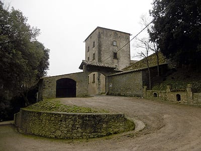
Montesquiu
The route will allow us to walk around the Park of the Castle of Montesquieu and reach the chapel of Sant Moí, a Pre-Romanesque building or very primitive Romanesque, probably built in the late X century.
Duration: 4 h 30 min
Dificulty: medium
Starting and ending point: castle of Montesquiu
More information: Local trails
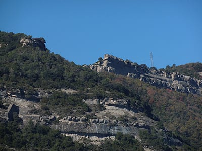
Castle of Montesquieu has its origin in the enclave of a guard tower that was built by the Count Guifré El Pilós in the ninth century. Different people have lived in it till its last owner Emili Juncadella. At the end of the route on a platform of about 1025 m high there are the remains of the castle of Besora and the Romanesque church of Santa Maria.
Distance: 9,5 km
Lenght: 3 h 30 min
Dificulty: medium
Starting and ending point: castle of Montesquiu and castle of Besora
More information: Local trails
Olost
Circular route that goes along paths and tracks through cultivated fields, pastures and forests, allowing us to imagine ambushes by the gangs of bandits in Llucanes. The route passes different farmhouses, crosses the stream of San Genis and ascends by a shady path among vegetation of a forest and the bank to the Spring Water of Malany.
Distance: 5 km 280 m
Duration: 1 h 30 min
Starting point: Espai Rocaguinarda
More information:http://es.wikiloc.com/wikiloc/view.do?id=6946481
Orís
The route will let us visit the ruins of the castle of Oris where we will enjoy beautiful views of the land, the church of Sant Genis, forests and cultivated fields of Oris with their farmhouses and the Romanesque chapel of Sant Salvador de Bellver.
Distance: 9,5 km
Duration: 3 h
Starting and ending point: Parish of Sant Genís a Orís
More information: Local trails
Oristà
Distancia: 6,1 km
Duración: 2 h
Inicio y fin: plaça Catalunya d’Oristà
Más información:http://www.senderismeorista.blogspot.com.es/p/ruta-1-sant-sebastia.html
Ruta carenera que nos llevará a conocer lugares de gran belleza y diferentes panorámicas del pueblo de Oristà.
Distancia: 9,6 km
Duración: 2 hores i 30 minuts
Inicio y fin: plaça Catalunya d’Oristà
Més informació:http://www.senderismeorista.blogspot.com.es/p/blog-page.html
Prats de Lluçanès
Places of interest of the path: Sant Sebastià and Sant Andreu de Llanars.
Distance: 5,2 km
Duration: 1h
Starting point: Nova square – Road to Navàs
More information: Local trails
Roda de Ter
The route At the view of the Ter connects life and work of two poets Verdaguer and Miquel Martí i Pol. It goes along the path near the Ter and that connects Folgueroles and Roda de Ter. It’s an old path which was used by workers of Folgueroles to go to work to the factories of Roda.
Circular route
Distance: 14 km
Little slope.
More information: Local trails
Rupit
Passing along both sides of the stream is the classic route of Rupit. The descent on the left side of the stream can be done in half an hour, while the ascent by the track of St. Joan de Fabregas will take you about an hour.
Duration: 1 hour and 40 minutes
More information: Local trails
The most interesting point of the route is anthropomorphic tombs located in Bassis. From here there is a stunning panoramic view of the environment.
Duration: 1 hour and 45 minutes
More information: Local trails
Sant Bartomeu del Grau
This route combines elements of Romanesque art which we can find in Sant Bartomeu del Grau. This is a varied route of trails and tracks. The path can reach the parish of Sant Jaume d’Alboquers following GR-3 in the southern direction.
Distance: 10 km
+Info: Local trails
Sant Julià de Vilatorta
Circular route, short and pleasant which connects some of the places of hydrological interest which surround environ of Sant Julia de Vilatorta.
Distance: 5,5 km
More information:http://www.vilatorta.cat/municipi/visitans/itineraris/itinerari-de-puigsec.html
This route visits the main sundials which are well-preserved and put on some facades of the town. The itinerary begins at the Park of the Seven Spring Wells. Although it is a circular route, we can start and finish it where we want.
Distance: 3,37 km
More information:
http://www.vilatorta.cat/municipi/visitans/itineraris/itinerari-dels-rellotges-de-sol-dificultat-baixa–337-km.html
Santa Maria de Besora
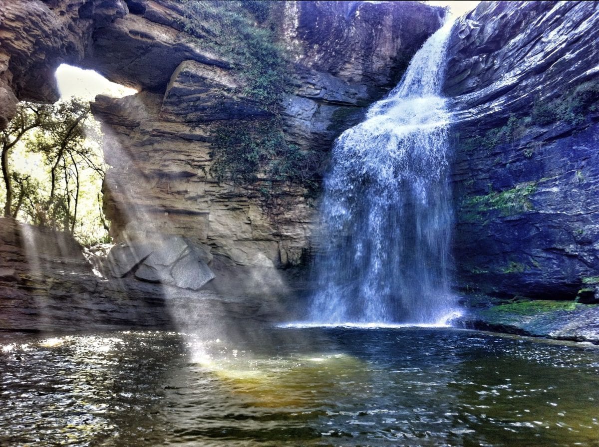
The waterfall of Mir, 35 m high, is a place of great beauty. The sight is spectacular, especially if the waterfall brings abundant amount of water. We should mention the accumulation of lime under the waterfall. The three buildings almost in ruins were the property of old flour mills where we can still see some part of the mechanism.
Path: GR 151
Duration: 1h 30 min
Dificulty: easy
Starting point: Santa Maria de Besora – Ending point: Salt del Mir
More information: Local trails
Bufadors is a place of great beauty that has magical atmosphere. Large blocks of rock covered with moss and very particular flora draw holes or cracks where the air flows from. Sometimes you can feel the air whistling inside; that’s where the name Bufadors (Blowers) comes from.
Duration: 2h 30 min
Dificulty: easy
Starting and ending point: Coll de Beví
More information: Local trails
Seva
Hike to the rural chapel of Santa Madrona and Menhir de Perafita.
Distance: 6,7 km
More information:http://www.seva.cat/ini.php?area=tur&pag=2&accio=detall&id=1
We encourage you to discover a little more of Seva’s past through the 5.2 km circular route of the Mills.
The route will start in Plaça de la Creu and we will head north. Once we have left the last houses in the town center, we will go down slightly until we pass by the Seva Cemetery itself. Shortly afterwards we will pass by the Masia Can Roca and begin the descent that will take us to the Molí Xic.
After a pleasant visit to the Molí Xic, where we can enjoy the whole of its structure, we will cross the river Gurri and there we will discover the remains of the Molí de Sors and the Pont del Molí del Sors (also called Pont d’en Gatus) .
And since we are not tired yet, we will then cross the Gassala torrent and with a little effort we will face a slight climb until we find the path that diverts us from the main road. We will cross the Gurri river again above the stones and we will enter towards the leafy forest, there we will discover a small botanical itinerary.
Finally we can finish this wonderful route returning to the town of Seva passing by the Font del Sors to return to our starting point.
Distance: 5.2 km
Elevation gain: 142m
Suitable for all audiences.
More information:https://www.seva.cat/index.php/turisme/ruta-dels-molins
Sora
Surrounded by pine trees, the property of Rocafiguera, there is a large redwood of Wellington known for Bella Antonia. The tree rises up to 28 and 35 meters and has a circumference of five meters at 1 meter from ground level. It takes three people to embrace it. In the mid-nineteenth century it was fashionable among certain social classes to plant foreign species of trees in the vicinity of large mansions in the country.
Duration: 5 h
Dificulty; high
Starting and ending point: Sora
More information:http://www.turisme.gesbisaura.cat/index.php?option=com_content&view=article&id=129&Itemid=138
Taradell
We propose an itinerary to get to know basically our old town penetrating also in areas of natural interest.
More information:http://www.taradell.cat/el-municipi/turisme/rutes-i-senders-100/itinerari-nord-sud.html
Tavèrnoles
Pretty flat route: goes up only at the initial stretch of Escales del Foquers 50 meters approximately, 250 steps, the rest of the route is flat passes through remarkable places of intrerest of Verdaguer.
Distance: 6 km
More information: Local trails
This circular hike allows us to visit environ of Savassona Plain, one of the most unique archaeological heritage sites at local level. As there are many elements of interest, it is easy to make the excursion one hour longer than the estimated time. We recommend enjoying the view from the chapel of Sant Feliuet and immerse yourself into the discovery of existing sites.
Distance: 6 km
Duration: 1h 40 min
More information: Local trails
Route of ascents and descents with three sections of relatively sudden irregularities of 100-150m. Walk through depths and elevated stretches. Places of great interest such as the area of the Savassona and the chapel of Sant Feliuet. The route follows the path PR C-40.
Distance: 9 km (one-way)
More information: Local trails
Tavertet
The route passed from Tavertet to Sant Corneli which was rebuilt in 1717 on the former chapel of century XIII. The chapel is very small, of a single nave. Latria is a communicator, the only one there in Collsacabra. The tower is of 1868.
Duration: 2 h 30 min
Dificulty: medium
More information:
http://www.tavertet.cat/detall_ruta.phpidR=15&idFamilySup=&idFamily=19&idSubFamily=103&rec=1&tipus=1
In Puig de la Força there was a castle, attributed to Tavertet family, built in the century XII on the ruins of an earlier one. There are the remains of some walls and a cistern or imprisonment. Different trails and viewpoints allow views on Sot de Balà, the nose of Abella,…, all of them of great beauty.
Distance: 6 km
Duration: 3h
More information:
http://www.tavertet.cat/detall_ruta.phpidR=14&idFamilySup=&idFamily=19&idSubFamily=103&rec=1&tipus=1
Tona
Route through space and time with an important thread to follow: water. We’ll visit different vestiges of people: Iberian (Iberian ovens), Romans (the site of Camp of Slabs) and medieval (Sanctuary of Lourdes and the plain of the Castle) till the contemporary one of residential zone Roqueta where you can enter the well of a former spa, taste and smell the sulphur water of this spring. We will also pass in front of the modernist stately towers and an old spa Ullastres.
Duration: 3hours
More information:http://www.tona.cat/municipi/guia-del-municipi/rutes/ruta-de-laigua.html
Very flat path, which can be done on foot or by bicycle, made for elderly people who want to walk easily without going too far from the town.
Distance: 4 km
Starting and ending point in Església square.
More information:http://www.tona.cat/municipi/guia-del-municipi/rutes/sender-de-vilageriu.html
The hills testify to the relic of the geological history of the area. Environ of Tona surprises by the diversity of landscapes that can be seen. The landscape is typically agricultural but it is fragmented by the small islands that make up the hills of Osona Plain protected by the PSNI. These hills, called “witness hills”, testify relic geological and primitive plant landscape history of the Plain of Vic.
Distance: 6 kms.
Time: 2 hours
Starting and ending point in Església square.
Circular route.
More information:http://www.tona.cat/municipi/guia-del-municipi/rutes/ruta-dels-turons.html
Torelló
Following the stretch of Ges bank that we propose, we’ll pass Ges Valley along the river from Torello to Sant Pere, enjoying the riverside forests and farmhouses scattered throughout the valley.
Distance: 8,5 km
Duration: 1 hour 45 min
More information:
http://www.turisme.gesbisaura.cat/index.php?option=com_content&view=article&id=139&Itemid=148
Vic
Natural circuit around the city articulated by a group of enclaves of high ecological, scenic, historical and cultural value, which allows us to appreciate socio-culturally and environmentally the outskirts of the city and enjoy the municipality.
Distance: 32 km
More information:http://www.victurisme.cat/quefer.php?idm=1&sub=2&sc=47&ng=82
The Mèder is a little slow flowing river formed by streams of Muntanyola, of Santa Eulalia and of Riuprimer and Sant Joan del Galí The route goes through the last stretch of the river just before entering Vic and allows us to observe the wildlife and vegetation of riparian forests closely. In the rainy season it is necessary to use shoes since we can get wet crossing the river.
Linear route
Distance 8 km
Starting point: Blanqueig Bridge
More information:http://www.victurisme.cat/quefer.php?idm=1&sub=2&sc=14&ng=36
The river Gurri is born at the foot of Montseny and flows into the Ter and after receiving water from Mèder to the city of Vic. Despite having a slow flow, the two rivers favored the development of the industry of the tanneries, especially Mèder which crosses the city. Its water had a high degree of pollution but now with the start of operation of the treatment plants its condition has improved very much. The route can be started on the right bank of the river and return along the left bank.
Circular route
Distance: 5,1 km
Dificulty: easy
Starting point: Parc de Xavier Roca i Vinyes
More information:http://www.victurisme.cat/quefer.php?idm=1&sub=2&sc=14&ng=37
The plain of San Sebastian (770 m.) with a chapel on its highest point is a place well known and appreciated by the people of Vic. The profile can be seen from many parts of the city and the location makes it a splendid viewpoint on the city and the plain. The route begins at the sports zone of Vic and goes partly through the municipality of Gurb. In the final stretch it coincides with the environmental route around Mèder..
Circular route
Distance: 15,4 km
Starting point: Youth Hostel Canonge Collell (Town sporty area)
More infomation:http://www.victurisme.cat/quefer.php?idm=1&sub=2&sc=14&ng=38
Vidrà
Puigsacalm, of 1,514 meters high, is located halfway between the regions of Osona and Garrotxa. It’s one of the most famous peaks of Catalonia and one of the most classic excursions of Catalan hiking. The views from the top are excellent on a clear day. It even lets us see the bay of Roses. Going up from Vidrà we’ll find the XII century Romanesque chapel of Sant Bartomeu de Covildases in the middle of meadows. The sight is of extraordinarily beautiful. Going back we’ll pass through beautiful neighborhood of Ciuret located in a wonderful place.
One way path: GR 151.1 / Return path: Local path of Puigsacalm
Duration: 7 h
Dificulty: high
Starting and ending point: Vidrà
More information:
http://www.turisme.gesbisaura.cat/index.php?option=com_content&view=article&id=131&Itemid=140
One of the biggest waterfalls of the river Ges. Its 20 meters high were used, as the ancient ruins demonstrate to us, to operate a mill; that’s from where its name derives.
Distance: 4 km
Duration 1 h
Starting point: Vidrà
More information:
http://www.turisme.gesbisaura.cat/index.php?option=com_content&view=article&id=132&Itemid=141
Viladrau
A pleasant route, ideal for making the first contact with Viladrau and Montseny. The route follows paths and trails that will allow you to get to know, within a simple hike, some of the natural, cultural and landscape elements most characteristic of our population. The paths will take you among cultivated fields and old farmhouses till reaching an idyllic site where Chestnut of 9 Branches dominates.
Circular signed trail
Starting point: Sot de Can Rosell Fountain. 15 minutes far from Major square.
Duration: 1,30h
More information:http://www.viladrau.cat/ca/turisme/rutes/sender-del-castanyer-de-les-9-branques-sl-c81
One of the most classic ascents of Montseny explained by Artur Osona in 1876, now by the northern side, the most forested. Path of continuous rise going through a number of forested and spectecular stages of Matagalls till culminating in meadows and bushes of the peak. At arrival, wide landscapes and views of the whole Montseny.
Signed trail
Starting point: Coll de Borderiol (15 m by car from Major square)
Duration: 4,5h
More information:http://www.viladrau.cat/ca/turisme/rutes/cami-de-matagalls-sl-c82
Short and quite flat route that brings us to the Mas la Sala, the birthplace of the famous sixteenth-century bandit called Joan Sala (Serrallonga). The trail also reveals other points of interest, such as Swallow Spring Well or the sundial of Mas Molins, all the time passing through places that make us relive the legend of Serrallonga.
Starting point: Torrent roundabout, close to Montseny Avenue
Distance: 8 km
Duration: 2h
Vilanova de Sau
Quite flat route with panoramic views on Sau Reservoir and its surroundings. The return is by the same path. All the time we’ll follow GR 2 and is suitable for mountain biking.
Distance: 6 km
More information:http://www.vilanovadesau.cat/turisme/rutes-pel-municipi.html
Not very long circular route but with quite steep slopes. It’s worth mentioning the panoramic views of Guilleries, Montseny, the plain of Vic, Cabrerès and the Pyrenees.
Distance: 6,5 km
More information:http://www.vilanovadesau.cat/turisme/rutes-pel-municipi.html
Not very long route but with steep slopes going up the cliffs (400 m in a distance of 1.6 km). Major part of the trail is signed by GR 2. From the top of the cliffs of Tavertet we can enjoy spectacular views on the valley of Sau.
More information:http://www.vilanovadesau.cat/turisme/rutes-pel-municipi.html
This trail is a two hours roundhike with medium unevenness which brings us from Malafogassa to Vilanova de Sau going through lush forests of oaks and pines.
Distance: 2,5 km
More information:http://www.vilanovadesau.cat/turisme/rutes-pel-municipi.html

tornar enrere